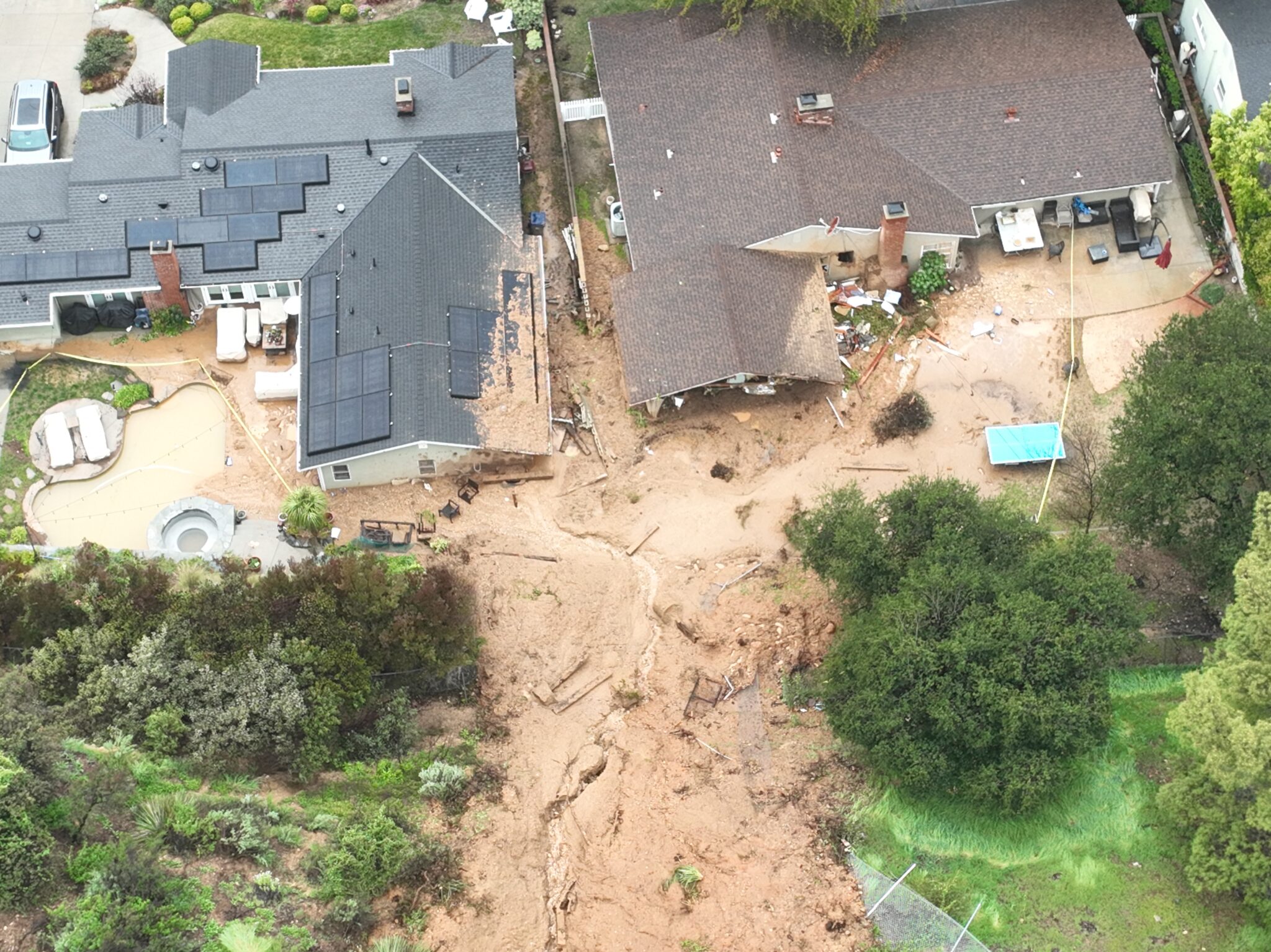
 An aerial view of landslide damage in La Cañada Flintridge, California on Monday, Feb. 27, 2023. Credit: Allen J. Schaben/Los Angeles Times via Getty Images
The series of intense storms started on the last day of 2022, resulting in early January floods that killed 22 people and a federal emergency declaration in 17 counties. In late February, extreme snow accumulations in the Southern California mountains north of Los Angeles led to several more deaths after trapping people inside their homes for days. Huge snowstorms along the length of the Sierra Nevada mountains that traverse the eastern edge of the state crushed roofs, downed trees and blocked highways.
Now large parts of the state are under flood alerts, with 10 inches or more rain expected March 14 and 15 in some areas. And satellite images show there could be more dangerous storms ahead, state climatologist Michael Anderson said at a March 13 briefing.
“We have this little blob showing up here, with a couple of little tendrils extending,” he said, showing a weather map during the online presentation. “And that gives us the sense that this is either one or two atmospheric rivers that may be forming up,” to affect the state between March 21 and March 23, he said. “The worst-case scenario would be back to back atmospheric rivers in that time period.”
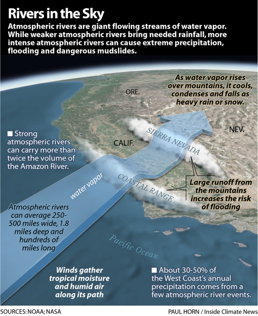
Atmospheric rivers are concentrated streams of moisture extending from the tropics or subtropics to mid-latitudes, generally more than 1,200 miles long, up to several hundred miles wide and between 1 and 2 miles deep.
Recent studies have shown that atmospheric rivers caused about half of the total flood damage in the West during the last 40 years, and that they are very likely to carry even more moisture as the climate continues to warm. And this year’s super-size California snowpack and the state’s trend toward hotter and earlier heat waves are increasing the risk of rain-on-snow floods.
Science Sees More Climate Whiplash Ahead
This winter’s wet storms followed the state’s driest three years on record, and the extreme and sudden shift between dry and wet is characteristic of the changes global warming is projected to bring the state, UCLA climate scientist Daniel Swain said during one of his regular webcasts about California weather and climate. The most recent historically wet year was 2017, and that was also preceded by what was then a record three-year dry spell.
“We’ve seen two historically severe droughts in the past decade, and now it appears we’ve seen two historically wet winters in Northern California, in this same decade,” he said. “This is really just playing into this notion that we’re likely to see both more precipitation and hydroclimate whiplash in California as the climate warms.”
The same pattern is playing out globally, according to a March 13 study in the journal Nature Water, which analyzed satellite data to show that “hydroclimatic extreme events are increasing in frequency, duration, and extent under warming conditions.” Their data, from instruments that can precisely measure water masses with very sensitive gravity sensors, show that, from 2002 to 2022, the intensity of extreme wet and dry events increased sharply and such extreme events correlated with rising global surface temperatures.
Last winter brought all-time low levels of precipitation to California and this winter has delivered all-time wet records, “including some of the wettest one-day events that some places in California have seen in over a century,” he said. The atmospheric river that hit the state in recent days carried some of the moistest air ever recorded in California during the month of March.
“One of the most direct impacts of climate change is raising the ceiling on how much moisture can be in the atmosphere,” Swain said. All the recent extremes represent data “that has not yet been formally entered and analyzed,” he said. “But it definitely points in the same direction as predictions from climate models and theory that have been, for a long time, about an increasingly whiplash-y hydroclimate In California.”
California is Different
Some people may also be surprised to learn that the climate models also project that the state’s average precipitation will remain about the same, in stark contrast to the trends and projections for significant overall desiccation in the Mediterranean and other similar climate regions, he said.
The reason for that is complex, and related directly to the way global warming is shifting the boundaries of ocean-spanning masses of rising air that bring low pressure, clouds and condensation, and sinking air that increases pressure and leads to stable, dry conditions.
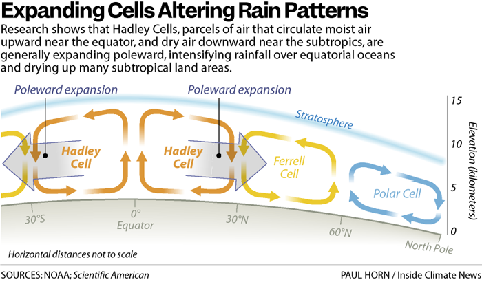
In most parts of the world, the stable bubbles are shifting poleward, heating and drying larger expanses of land in regions like northern Africa, Southern Europe, parts of Mexico and the Southwest U.S. Climate scientists have known this, and warned about it, at least since 2004, when NOAA scientist Xiao-Wei Quan and his team wrote that the shift is associated with “increased equatorial oceanic rainfall, and a general drying of tropical/subtropical landmasses.”
But California, Swain said, has not been affected by that shift in the same way, and has not seen a significant decrease of average annual precipitation since the late 1800s.
“The boundary in general between the sub tropics and the mid latitudes is shifting poleward almost everywhere on Earth, he said, “except interestingly, for the North Pacific just west of California, where it does not appear to be doing this, which is one of the reasons why California is not currently projected to get dramatically drier.”
“It’s not entirely clear why that’s the case,” he added.
Climate change could also fuel even more extreme snowfall in higher mountains, to a point, he said. So far, there hasn’t been a decrease of extreme snow seasons and extreme snow events, even though average snowfall has decreased, he said.
“But at elevations or seasons when the air is still cold enough, the wet air streams flowing in will have significantly more moisture to be squeezed out as snow,” he said.
That could explain why some parts of California are experiencing snow events at least as extreme as anytime in their historical records, he said.
“The average snowpack is still likely to decrease in a warming climate despite the fact we’re going to continue to get these big, disruptive years in between,” he said.
A Distinctly Warming Climate With Wetter Wets
Even though many Californians are enduring the most frigid winter of their lifetimes, Swain said none of the state’s cities have yet set all-time records for cold temperatures.
“We’ve seen very, very few, if any, all time low temperature records this winter,” he said. “It’s been a very cold winter in California by the standard of the last 30 years, “but of course that’s a moving target.”
During the last 30 or 40 years, California has warmed considerably, he said, with current temperatures about 3 degrees Fahrenheit higher than those of the late 1800s.
”If this winter’s pattern had happened a century ago, the temperature might have resulted in snows at sea level,” he added. There “would have been even larger snow accumulation events.”
Research by Swain and others suggest the state’s climate whiplash will be sharper on the wet side than the dry side, he said.
“We will see drier dries and wetter wets. But it’s really the big, huge precipitation events that get wetter at the expense of most of the other precipitation events,” he said. “That’s what we’ve been seeing this year.”