The geoenergy observatory in Cheshire aims to provide a facility for scientists and innovators working on subsurface energy storage projects. It will be equipped with a range of subsurface technologies including borehole heat exchangers, sensors for real-time 3D imaging of subsurface processes, and equipment for multilevel ground water monitoring and hydraulic control.
The observatory will be available to the whole of the UK science community for research, innovation and training activities. It will support the development of one of the most comprehensive datasets in the world on the geological environment, with data free and open to the public, public bodies, researchers and industry.
The UK Geoenergy Observatories had also recently opened the Glasgow Observatory for both commercial and academic researchers to conduct a range of experiments on mine water geothermal.
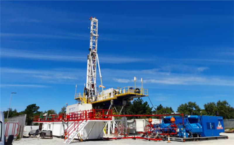
Complex drilling operations
The drilling phase lasted 10 months and involved the drilling of 20 boreholes, each to a 100-meter depth, within a small 36 m x 36 m area. The tight spacing and the complexity of the boreholes extended the drilling period. The boreholes were designed with fibre optic cables, an array of sensors, heat-exchange loops, and water sampling ports.
Moreover, a number of centimeter-scale fractures were observed running almost horizontally through the borehole array. This made drilling more challenging, as the team wanted to avoid modifying these fractures either by enlarging or clogging them.
Valuable data collected during drilling
Aside from establishing the borehole infrastructure, the drilling phases also yielded scientific data that will help understand the aquifer in greater detail. The data includes wireline logs, core sample analyses, core scan data, aquifer hydraulic parameters, ground water chemistry, and data on the borehole grouting process.
The drilling data will be freely shared online in due course.