A preprint outlining the methods and the findings can be accessed here: https://doi.org/10.48550/arXiv.2403.09961
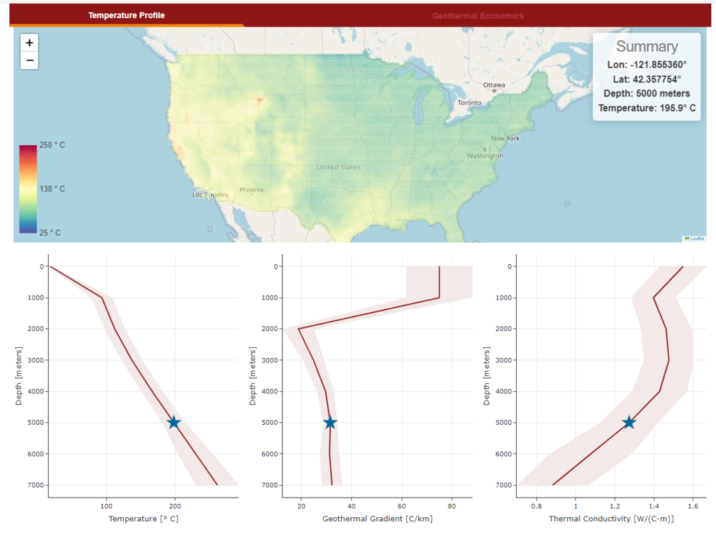
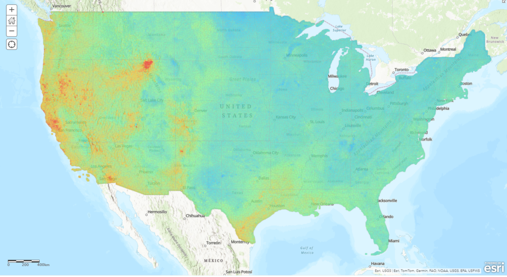
Sample temperature profile generated using the Stanford Temperature Model (source: Website screenshot, Stanford Temperature Model)
The Stanford Thermal Earth Model was generated using inputs from more than 400,000 bottomhole temperature measurements. Other inputs included data on depth, elevation, geographic coordinates, sediment thickness, magnetic anomaly, gravity anomaly, gamma-ray flux of radioactive elements, seismicity, and electric conductivity.
The data was then processed using physics-informed graph neural networks. The model was trained to simultaneously predict subsurface temperatures, surface heat flow, and rock thermal conductivity, hence satisfying the three-dimensional heat conduction law.
The model showed superior temperature, surface heat flow and thermal conductivity mean absolute errors of 4.8C, 5.817 mW/m2 and 0.022 W/(C-m), respectively.
The model by Aljubran & Horne joins a growing list of works that aim to make data on subsurface temperatures publicly accessible. Such efforts are instrumental in the identification of potential sites for geothermal projects, as well as in the communication of risks and opportunities to stakeholders. Noteworthy examples include the following:
GeotIS platform for Germany by LIAG;
the Superhot Rock Project Map by CATF;
the ICGC Interactive Map for Catalonia;
the Global Heat Flow Database by the IHFC;
the GeoMap by Project Innerspace.